Understanding the Missouri Compromise and Its Impact on Texas
Published: 1952
Updated: April 1, 1995
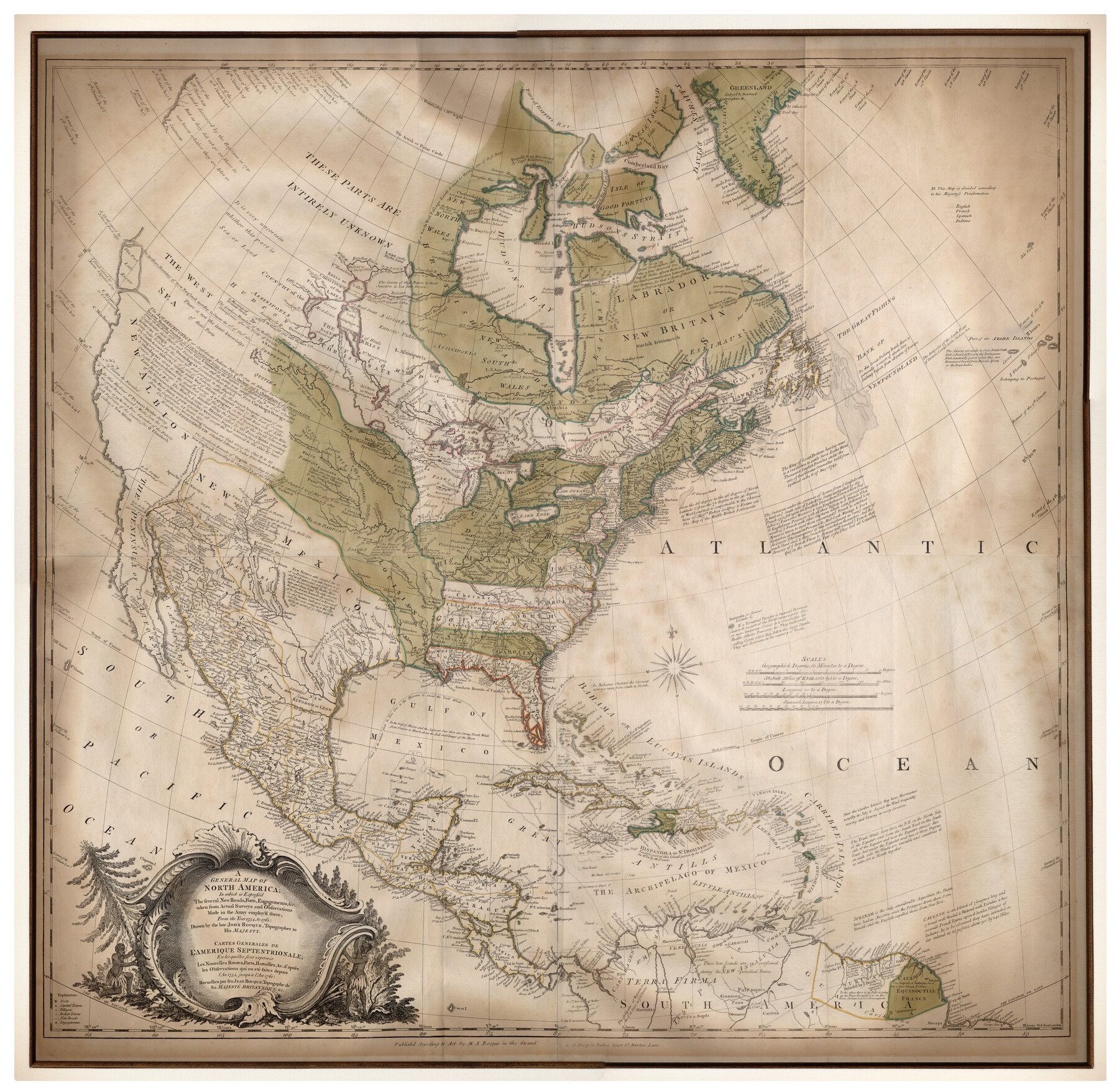
The parallel of 36°30' north latitude, the southern boundary of Missouri, was established by the Missouri Compromise of 1820 as the northern limit of that part of the Louisiana Purchase that could be slave territory. Because of the Adams-Onís Treaty Texas was not considered a part of the Louisiana Purchase; therefore the annexation resolutions passed by Congress on February 28, 1845, included a restriction that if Texas were to be divided into more than one state, any state established north of the Missouri Compromise line (which was thus extended westward across Texas) would be a free state. In 1850, as a part of the Compromise of 1850 the northern boundary of the Texas Panhandle was fixed at the Missouri Compromise line, thus avoiding conflict in interpretations and making Texas clearly a "slave state." See also SLAVERY.
Bibliography:
The following, adapted from the Chicago Manual of Style, 15th edition, is the preferred citation for this entry.
Seymour V. Connor, “Missouri Compromise,” Handbook of Texas Online, accessed April 11, 2026, https://www.tshaonline.org/handbook/entries/missouri-compromise.
TID:
NBM01
- 1952
- April 1, 1995
This entry belongs to the following special projects:

Is history important to you?
We need your Support because we are a non-profit that relies upon contributions from our community in order to record and preserve the history of our state. Every dollar helps.
I Want to Help Support the Preservation of Texas History→


Share this entry on social media: